Geochemical data
Type of resources
Topics
Keywords
Contact for the resource
Provided by
Years
Formats
Representation types
Update frequencies
Scale
-
Includes XRF elemental abundance data, LECO data, organic geochemical data (GC-MS), and os-isotope and associated Re and Os abundance data. Geographical area - primarily France (Paris and Voncontian Basin), UK (Yorkshire coast), and Japan (Toyora area, Yamaguchi Prefecture). Also includes globally distributed palaeotemperature data.
-
Organic and inorganic data extracted from core material spanning over a large area of the Baltic basin (Kostovo-13, Grotlingbo-1, File Haidar-1, Boda Hamn-1, Hamnudden-1, Finngrundet-1, Barstad-2 and Bernstorp-1). Organic data include concentrations in pristane, phytane, phenanthrene, methylphenanthrene and arylisoprenoids. Inorganic data include iron speciation data, concentrations in Fe, Al, P, U, Mo, V, total organic C, and C isotope ratios.
-
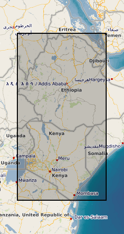
Digitized GIS geological and geochemical datasets taken from maps and reports as part of BGS Overseas Development Research in 1980-90s.
-
Series of water/rock and water/mineral interaction experiments at a range of temperatures and pressures. Most experimental runs now held in Excel spreadsheets. All runs held as paper records in the laboratory. Analytical results also held in Excel format. Kinetic information held in Access database for a range of minerals. Also have several reference datasets in Hypercard and End Note.
-

Geochemical and isotopic data presented here cover the Paleocene-Eocene Thermal Maximum (~56 Ma ago) and were produced to assess the degree of carbon cycle perturbations, ocean acidification and the origin of the emitted carbon added to the atmosphere-ocean system during this major carbon cycle perturbation event. For further details on the analytical approach please refer to the original publication (Gutjahr et al., 2017, Nature). Data contained within the two tables comprise foraminiferal carbonate based stable boron, carbon and oxygen isotopic results from DSDP Site 401 located within the Bay of Biscaye in the NE Atlantic (Table 1). This table also contains B/Ca, Mg/Ca and Al/Ca data from the same samples. Depth in core is presented alongside two alternative relative age models setting ages in relation to the Carbon Isotope Excursion observed during the Paleocene Eocene Thermal Maximum. Table 2 contains high-resolution bulk carbonate stable carbon and oxygen isotopic results that were produced to establish a new age models for this core.
-
Isotope analysis data. Project details: The continental crust is our only archive of Earth history; not just of the crust itself but of the hydrosphere, atmosphere and biosphere, and of the deep Earth through its interactions with the crust. This archive, like the rock record itself, is incomplete and much effort is focused on interrogating the crust to gain a clearer and more complete picture of Earth history. The continental rock record is episodic with, for example, ages of igneous crystallization, metamorphism, continental margins, and seawater and atmospheric proxies distributed about a series of peaks and troughs that in part correspond with the cycle of supercontinent assembly and dispersal. At the core of the debate is what these well-established peaks of ages in the geological record represent and how they develop. The peaks of ages correspond with periods of global assembly of continents to form supercontinents. The project will address whether the peaks of ages are primary features associated with supercontinent assembly or break up, or they are they secondary features representing greater preservation potential at the times of supercontinent assembly. Our work will focus on the Rodinian supercontinent cycle, which extends from initiation of convergent plate interaction around 1.7 Ga, to continental collision at 1.1-1.0 Ga during the Grenville orogeny, to final breakup of the supercontinent by 0.54 Ga. Detrital zircons from sedimentary units throughout the supercontinent cycle provide a record of the magmatic activity for which the igneous rocks are often no longer preserved. We will determine (i) the ages ranges of magmatic activity preserved in the sedimentary rocks in the 600 Ma pre-collision phase, and (ii) how and when the distinctive Grenville peak of ages developed by comparing the zircon record from samples pre-, syn- and post- Rodinian supercontinent assembly with estimated volumes of magma and numbers of zircons produced during the same interval. This will differentiate primary generation processes from secondary processes, constraining when the dominant age peak developed, the tectonic processes that operated, and hence the method by which it developed. The wider implications of when the continental crust formed are considerable. Studies of continental growth continue to uncritically assume that the geological and isotopic record provide insight into processes of crust formation. Until it can be established whether the record is the outcome of generational or preservational processes, or a combination of both, then drawing conclusions on this fundamental question in the Earth Sciences are premature. If the record is a preservational record then this impacts on understanding continental growth through time and on secondary questions of how the crustal record is used to unravel the temporal evolution of the hydrosphere and biosphere, and the distribution of mineral deposits.
-
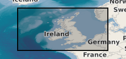
BGS has drilled almost 600 boreholes to prove seismic interpretations of the marine Quaternary geology and bedrock from the UK Continental Shelf (UKCS). The collection also includes additional third party data and has assisted in the creation of BGS Marine Geology Maps. The boreholes penetrate beneath the sea bed to depths ranging from about 10m to over 300m depending on the target depth or technical problems associated with drilling the borehole. The data includes descriptive geological core logs and data which has been captured from these and in some cases natural gamma logs. A variety of analyses has been conducted on the core material such as Particle Size Analysis, micropalaeontological, geotechnical, palaeomagnetic and age dating. Core material are managed as part of the BGS Materials collection and are available for examination and subsampling. The data are stored as part of the National Geoscience Data Centre (NGDC) and the Marine Environmental Data and Information Network (MEDIN) Data Archive Centre (DAC) for Geology and Geophysics. Data are delivered via the BGS Offshore GeoIndex http://www.bgs.ac.uk/GeoIndex/offshore.htm. The activity and scan layers contains location information, metadata and links to scanned borehole logs, and the geological data layers contain observations and/or measurements as digital values. The data are applicable to a wide range of uses including environmental, geotechnical and geological studies. Reference: Fannin, NGT. (1989) Offshore Investigations 1966-87 British Geological Survey Technical Report WB/89/02, British Geological Survey.
-
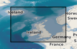
This dataset is the complete collection of the British Geological Survey (BGS) held Marine Survey data. The data held includes digital data and analogue records, plus associated physical sample material. Data are stored within the National Geosciences Data Centre (NGDC) and the Marine Environmental Data and Information Network (MEDIN) Data Archive Centre (DAC) for Geology and Geophysics. BGS have collected Marine Survey data since 1966 and have also been provided with a range of third-party data. The data includes geophysical data (seismic reflection, side-scan sonar, multibeam echosounder bathymetry and backscatter, gravity and magnetics) and sample data from boreholes, cores and seabed grabs (logs, geological descriptions, geochemical, particle size analysis and geotechnical data). The majority of surveys are within the United Kingdom Continental Shelf (UKCS) area. Individual survey data coverage varies, depending on survey type (sampling, geophysics, multibeam or multi-disciplinary) and objectives (regional or local, shallow or deep). These data are applicable to a wide range of uses including environmental, geotechnical, geophysical and geological studies. Data are delivered via the BGS Offshore GeoIndex www.bgs.ac.uk/GeoIndex/offshore.htm. Additional data are available on request enquiries@bgs.ac.uk.
 NERC Data Catalogue Service